Mar 08

Iguana Farm Visit

Number of View: 0

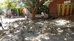
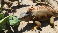
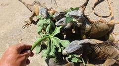
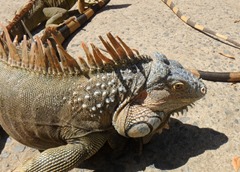
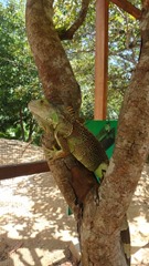
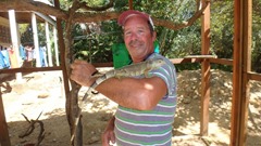
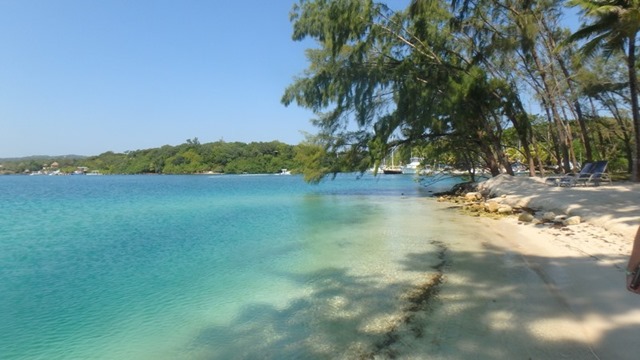
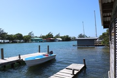
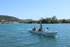
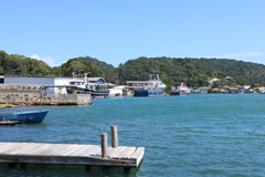
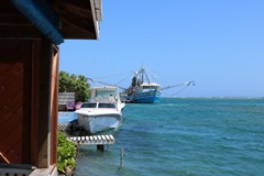
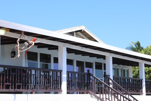
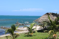
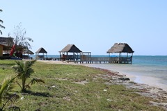
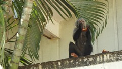
Just a short dinghy ride from our marina there is unique attraction. A wildlife preserve, known as the Iguana farm. We had passed by it a few times , but up until now, we never dropped in to see what it was all about. Soon after tying up our dinghy we were greeted by the numerous Tarpon, Snook, and Snappers swimming around the docks.

Image00002

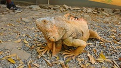
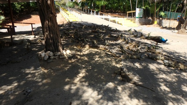
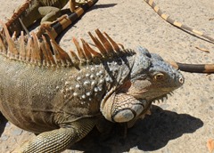
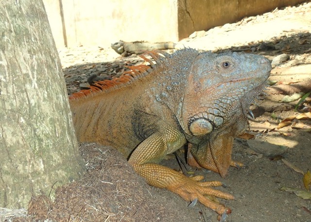
Founded in June of 1980, by Sherman Arch and his family. They have strived throughout the years to educate and inform the public in regards to excessive fishing and poaching. The family practices conservation,preservation, and protection of Roatan’s wildlife. On their property, hundreds of iguanas roam freely, and reproduce on the reserve. In the attempt to safeguard the Green Iguana, as well as the aquatic life, the Arch family works to earn a profit for the purpose of continued conservation of Roatan’s wildlife, as their love for the environment.

www.roataniguanaexcursions.com

Image00023 Image00024

Image00001  Image00022

Image00004

Image00015   Image00016

Image00013  Image00006

Image00007  Image00008

Image00011  Image00013

Image00014  Image00021

Image00017  Image00020

Check out the video at:………https://youtu.be/3LlCoql8zkM

Image00025

Mar 01

East End Trip

Number of View: 0

Image00001

Image00001  Image00002-001

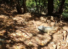
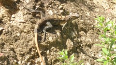
Spiny Tailed Iguana, are found only on the island of Roatan, in the Bay Islands of Honduras. The species is listed as endangered, with a population of around 4,500.

OLYMPUS DIGITAL CAMERA

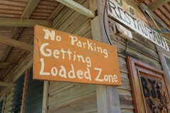
We went for a drive out to the East end of Roatan, visiting the bays , and stopping for lunch at a waterside restaurant. This is the least tourist side of the island, with some beautiful homes and out of the way resorts.

Image00001  Image00002

Image00003  Image00007

Image00005  Image00004

Image00008

Image00009  Image00010

Image00011  Image00012

Image00013  Image00015

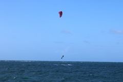
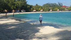
A Robinson-Crusoe type living can be enjoyed in this remote area of the island. Spending days on the beach, wind surfing, swimming, or just lounging, it is beautiful.

Image00016

Image00019  Image00018

Image00022

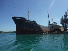
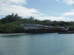
This is a unique disco bar, roadside shipwreck that is visited by up to 700 persons on weekends listening to the state of the art sound system. Grand Opening was in 2016 to a fantastic fireworks display. Isery means New,  in the native Garifuna language.

Image00023  Image00024

Image00025  Image00026

Image00028  Image00029

Image00001

Feb 20

Sargassum

Number of View: 0

Image00001

Image00003  Image00002

Image00004  Image00005

Sargassum is abundant in the ocean. Upon close inspection, it is easy to see the many leafy appendages, branches, and round, berry-like structures that make up the plant. These “berries” are actually gas-filled structures, called pneumatocysts, which are filled mostly with oxygen. Pneumatocysts add buoyancy to the plant structure and allow it to float on the surface.

Floating rafts of Sargassum can stretch for miles across the ocean. This floating habitat provides food, refuge, and breeding grounds for an array of critters such as fishes, sea turtles, marine birds, crabs, shrimp, and more. Some animals, like the Sargassum fish (in the frogfish family), live their whole lives only in this habitat. Sargassum serves as a primary nursery area for a variety of commercially important fishes such as mahi mahi, jacks, and amberjacks.

When Sargassum loses its buoyancy, it sinks to the seafloor, providing energy in the form of carbon to fishes and invertebrates in the deep sea. Sargassum may also provide an important addition to the food sources available in the deep sea.

Because of its ecological importance, Sargassum has been designated as Essential Fish Habitat, which affords these areas special protection. However, Sargassum habitat has been poorly studied because it is so difficult to sample. Further research is needed to understand, protect, and best conserve this natural resource.

Taken from the NOAA website, National Oceanic and Atmospheric Administration
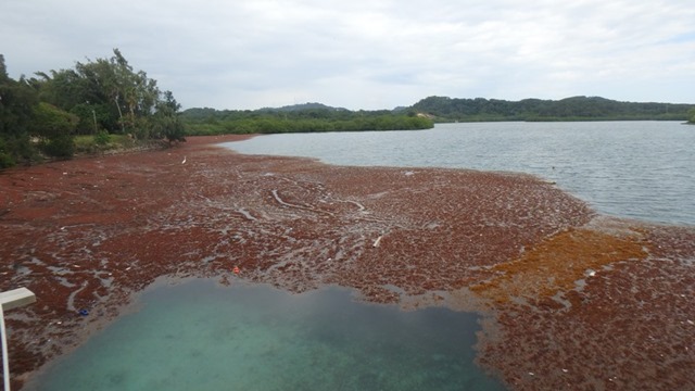
Image00018

Image00016   Image00017 

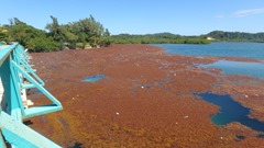
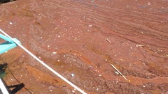
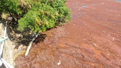
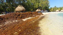
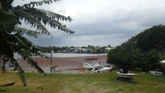
Since we have had a southeast wind for the last little while, the island has masses of this floating weed pushed in to most of the bays, plastics of all kind are mixed in. Workers at the resort raked and picked up, and trucked away all the debris in a couple of days, leaving the beaches, pristine once again. 

Image00004

Image00003

The main port , French Harbour is open but the small bays are covered with this floating mess. We got stuck and had to paddle up to the dock, where we were greeted by the attendant with his small fury friend. This is usually the easy access to town, which is a short walk.
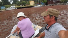
Image00004  Image00005

Image00019   Image00007

Image00020

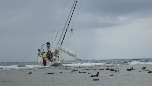
Early, this morning we came across this boat stricken on the reef. So sad to see someone lose their home and dreams, and brings to mind the dangers of sailing.

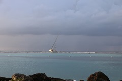
   Image00008  Image00007 

Soon after leaving the boat, the first of the looters showed up.

Image00003

Feb 09

The Monkey and Sloth Hangout, Roatan

Number of View: 0

Image00010

One of the most amazing attractions here on the Island of Roatan, is a visit to The Monkey and Sloth Hangout.This is not you typical, here you interact with the residents who seem to enjoy your company. The highlight was holding young 3 Toed Sloth. Our guide had climbed a tree overlooking the water to bring him down, All the animals move freely from inside the protected area to outside within the  compound. When a Cruise ship is in port, this is one of the attractions that is booked, but not today. We spent plenty of time with each group on animals.

Image00005  Image00006

Image00007  Image00008

Image00004  Image00009

Watch our Video at:

https://youtu.be/7w8vsi5tNmU

Fantasy Island Marina has been a enjoyable stop, great snorkeling, beautiful beach, safe docks, and friendly people. Each evening we sit and watch the sun set and relax on the ……..Dock of the Bay.

Image00001  Image00002

Image00003

Jan 28

West End, Roatan, Honduras

Number of View: 0

Image00001 Image00002 Image00004  Image00010

After the cold, Christmas Holiday season we spent with our kids……OK, OK , OK…we lost our rich Canadian blood, it is nice to get back to the warm western Caribbean sun. We had a long trip back, 35 hours in total, but was actually pretty good. No problem with turbulence or storms  the whole way.

Mistress was just the way we left her, a little bit damp on the inside of the cabin, but no mold, so we had very little cleaning to do. Our mornings are spent doing projects and repairs, and when it gets hot around mid afternoon, we head for the beach to go snorkeling

.Image00001  Image00002Image00003

Image00003  Image00004

We took the local bus, actually a 12 seated van, that they stuff 20 persons or more into, known as a Chicken Bus to the western part of Roatan. 

Image00007 Image00008 

Image00011  Image00012  Image00013  Image00014  Image00015  Image00016

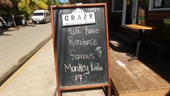
West End, is a beach community with many Restaurants and Bars serving all kinds of food, to be enjoyed overlooking the clear blue water. This is also home to the drink,  Monkey LaLa, a dessert for adults. It is delicious and dangerous…there are up to 4 kinds of alcohol in it – meaning one drink can have up to 4 shots in it. That much sugar can make for a pretty nasty hangover too. But an icy drink on a hot day at the beach is SO good! The drink is named after the ubiquitous lizard here, seen running across the road up on its hind legs – the islanders call it a monkey la-la, but its scientific name is the basilisk, but is also commonly known as the Jesus Lizard, because it can walk on water for a bit before sinking. I guess the drink is named appropriately, because I have seen plenty of people trying to walk on water and do other miraculous things after drinking 4 or 5 of them. And once I saw a lady drink 13 of them and after a snooze at the table (we thought she was dead) she was resurrected and proceeded to down another one. Jesus Lizard drink indeed!  

Image result for monkey lala

Image00002

This little guy, I rescued from the monkeys, who were beating him up, he was very young, and  obviously injured. A lady on the beach told me that the monkeys were taking him up the tree and throwing him off. I don’t think they were teaching him to fly. I don’t know for sure what type of  hawk this is, but I would think he should be high up in the trees surrounding the beach. He seemed to be a young bird who had all his flight feathers. I didn’t see any injuries. I removed my tee shirt, using it for protection from his claws, I moved him to the grass in the shade, to hopefully recover.

Dec 28

Roatan, Honduras

Number of View: 0

DSCF1433

Geography

The island rests on an exposed ancient coral reef, rising to about 270 meters (890 ft.) above sea level. Offshore reefs offer opportunities for diving.[1] Most habitation is in the western half of the island.

The most populous town of the island is Coxen Hole, capital of Roatán municipality, located in the southwest. West of Coxen Hole are the settlements of Gravel Bay, Flowers Bay and Pensacola on the south coast, and Sandy Bay, West End and West Bay on the north coast. To the east of Coxen Hole are the settlements of Mount Pleasant, French Harbour, Parrot Tree, Jonesville and Oakridge on the south coast, and Punta Gorda on the north coast.

The easternmost quarter of the island is separated by a channel through the mangroves that is 15 meters wide on average. This section is called Helene, or Santa Elena in Spanish. Satellite islands at the eastern end are Morat, Barbareta, and Pigeon Cay. Further west between French Harbour and Coxen Hole are several cays, including Stamp Cay and Barefoot Cay.

Location

Located near the Mesoamerican Barrier Reef, the largest barrier reef in the Caribbean Sea (second largest worldwide after Australia’s Great Barrier Reef), Roatán has become an important cruise ship, scuba diving and eco-tourism destination in Honduras. Tourism is its most important economic sector, though fishing is also an important source of income for islanders. Roatán is located within 40 miles of La Ceiba. The island is served by the Juan Manuel Gálvez Roatán International Airport and the Galaxy Wave Ferry service twice a day.

Image00018  Image00019

Image00017  Image00021Image00002

Image00022

Image00003  Image00001

Image00008  Image00003

Image00004  Image00001

Image00002  Image00005

Image00007

Text from Wikipedia

Dec 21

Guanaja, Honduras

Number of View: 0

Image00011

As was the case in most of the Caribbean, the first European to arrive was none other than Christopher Columbus. His first stop was right here at Isla de Guanaja, in the Bay Islands. Columbus named the land, Honduras, meaning, “depths”  for the deep water he found here, along the coast.

The history of Honduras began a long time ago, with the first settlers arriving by either walking across the Bering Strait Land Bridge, or by floating on rafts across the Pacific Ocean. Anthropologists theorize that these early Hondurans arrived around 10,000 BC.

For almost 20 years after Columbus’s visit, only a couple of Spanish explorers visited Honduras until 1522, when an expedition came. Their only true goal was to acquire wealth and power for the explorers involved.

The Spanish fought the local native tribes into the latter 1530s, and at one point almost were driven out. If only all the indigenous people in Central America had banded together, the outcome would have been far different. One leader, Lempira whose name means “Gentleman of the mountain”, was unusually successful against the invaders. Lempira, a tribe chief organized 30,000 fighters into a resistance force that the Spanish could not defeat in battle, so they resorted to treachery and deception.  Under a white flag of truce both sides met to negotiate a peace treaty. During the meeting, the Spanish shot and killed the Great warrior stopping the resistance movement entirely. Today Lempiras name is synonymous with the indigenous peoples heritage and so honored is the great leader that Honduras currency is named after him. By 1841  the number of indigenous Indians were around 8000,  approximately, 1%  of what their numbers were when the Spanish arrived.

Image00003  Image00012

Image00005  Image00015

Image00010  Image00009

Image00013 Image00014

Image00016  Image00018

Image00019  Image00017

Image00020

Dec 14

Route To The Rio

Number of View: 0

Image00005

Fellow Cruisers, Marj and Tom Lamb on mv 3/4 Time


After reviewing cruising guides, FB groups, numerous weather sites and Chris Parker { weather guru }, and considering advice from fellow cruisers, it looked like we had a solid sail plan. Years ago when we were in the Bahamas we bought a world radio off our friends Pat and Karl on Ishmael. This radio allowed us to pick up SSB channels and most important the weather report broadcast every morning from Florida, when internet is not available.

All was a go, we checked out of the country….. again, and  prepared Mistress, put together our defense system,  and enjoyed a beautiful sunset.

Image00001

Early the next morning we hoisted the anchor and motored out of the harbour to a mark 3 miles from the island. From there we turned north to pass through a reef and the coastline of Nicaragua this is where most of the boarding and thefts are reported to happen. Some say it is the fishermen trying to supplement their income others say if just a bunch or rowdies in boats. When you rob a boat you are a pirate and this is a known problem area.

For the first day, we motor sailed almost directly into the wind, doing a surprisingly 5 knots. The wind had been predicted to be more east, meaning the waves would be from the side. Even though the wind was light it seemed like we were travelling faster than we were, the sound of the wind can fool you. After sunset the wind became lighter and constantly shifted  direction. This caused the boom to slam, and the sails to pop, hard on the rigging but kept the boat steadier and avoid rolling. The next morning we were completely by Nicaragua. and at a place we could begin to ease the sails, and turn west and get a gentler ride. As the sun rose higher in the sky the wind died completely leaving us to sail along at 3 kts. The light wind lasted all day and night, we were still 200 miles away from our destination.

Day 3  Again light winds all day, we had been running the engine al night but now had to conserve fuel to make sure we would not run out. In the evening,a group of dark heavy rain clouds passed over us  one after another we got rained on till we were soaked to the skin. Our old foul weather  was no match. we must have changed 3 or 4 times only to get soaked again.

Image00006

Day 4, brought another problem, if we continued along at the present speed we would arrive at nigh tin the dark. The Harbour entrance is reef  strewn on both sides, no place for error. We could turn on the engine, but we would take the chance of running out of fuel,  or just slow right down, and drift for the last 75 miles.  This is what we did.

On the morning of day 5 we had Guanaja in sight and slowly made our way into the harbour.

   Image00007

Image00008  Image00009

Image00010 

Honduras Immigration Office

Dec 07

Providencia and Santa Catalina Islands

Number of View: 0

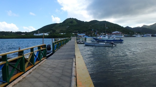
We wanted to leave at first light, to make our way out of the reef strewn harbour of San Andres, but were held up a bit getting the anchor up. We enjoyed our time here on this busy little island, you can see why tourists and travellers from mainland Colombia love it, almost anything is available.
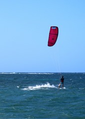
Once outside, in open water we set the windvane steering to handle the approx. 10 hour voyage.

Image00001 

Image00003    Image00004

  The islands of Providencia and Santa Catalina are located 80km northeast of San Andres. Their topography is much more abrupt than San Andres due to its volcanic origin which offers a particular landscape and varied vegetation. Providencia’s highest point in 360 m above MSL in a place called Peak. Providencia is comprised of cliffs and several cays, such as Crab Cay and Three Brothers Cay.

Image00005  Image00006

Image00007  Image00008

Image00010  Image00011

Image00009  Image00013

   The economic activity of these islands is based on agriculture, fishing, and tourism. The main means of transport for trading is the maritime ways.

   The islands have a reef bar of 32km, which is the longest in Colombia, and the second longest in the Caribbean.

Image00024

   Providencia and Santa Catalina are separated from each other by the Canal Aury, and are joined by the Lover Lane {Puente de los Enamorados}, which is a wooden bridge that links both islands.

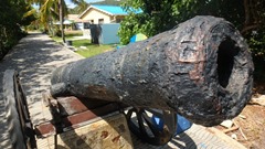
   These islands are connected by an artificial canal of around 100 m built by pirates to defend the islands in the 17th Century. The remains and the fortifications of the legendary corsairs Morgan and Aury are located in the islands.

Image00015   Image00016

Image00019  Image00020

Image00017  Image00018

Image00022  Image00023

   Approximately 200 yachts anchor on the bay every year, most of them come from Panama and Honduras.

Image00021

   Providencia is halfway between Jamaica, Belize, Honduras, Guatemala, and Grand Cayman.

   One of the main attractions is the migration of the Black Crab { Gecarcinus ruricola,} who migrate between April and June to spawn.

Nov 29

Touring around San Andres

Number of View: 0

Image00022

.Using public transit, we decided to tour the island to see some interesting sites. Stopping at the Casa Museo, were shown a typical house from the early 1900s, and learned how people lived back then. Very much like the early habitants of Canada, without snow. The locals here, for most part speak English, but in their own dialect known as Creole. Spanish is taught in schools, but those who do not speak English are considered foreigners. Colombia has restricted mainlanders from moving to these islands.

It is believed the first people who discovered  the islands were the Spanish who were heading to Jamaica in 1510. However some historians say it  was Christopher Colon [Columbus], on his second trip to the Americas.

One hundred years later, Dutch and English corsairs, Adventurers, and Smugglers referred to the islands as a group of cays, islands and islets surrounded by a sea of seven colours.

In 1629, a group of English Puritans arrived on the island and started to traffic black slaves from Africa. When they arrived at Providencia, they met the Dutch who had already settled here, and were in charge of trading throughout  the Antilles, the English colonized the land. Around that time, the king of Spain gave the order to expel the English, which took 36 years, before they finally settled in the territory. So the residents here are a mix of all the early visitors.

We were also given lessons on “ How to Dance”

Image00021

We visited a site which looked like a Film Set, that has a small cave, that is said to have been used Henry Morgan. A tourist stop, but an enjoyable way to spend the afternoon.

Image00008  Image00009

Image00011  Image00012

Image00013  Image00019

DSCF1216  DSCF1217

.Image00017   DSCF1219

Off to the Dungeon………!!!!!

Image00018

Image00025

We would like to thank our agent in San Andres, Julian Watson. He not only helped us clear in, but was our personal guide, who was a phone call away to answer any of our questions. We enjoyed our stay in your beautiful harbour.